The Baylands' New Living Levee Runs on Water From the Plant Next Door
November 12, 2026
November 12, 2026
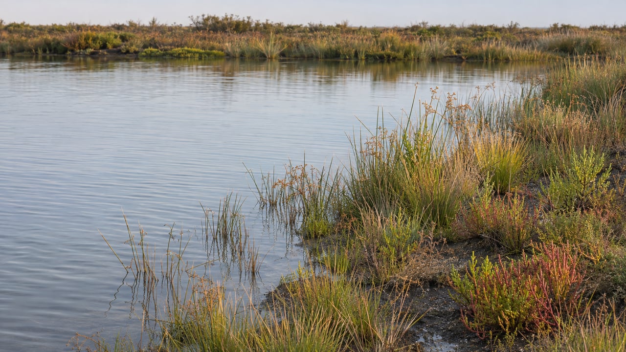
When a sink drains in Los Altos Hills, Mountain View, East Palo Alto or on the Stanford campus, the water ends up at Palo Alto's Regional Water Quality Control Plant at 2501 Embarcadero Way. Some of that treated water now has a new job. It is meant to irrigate a planted slope on the shore of Harbor Marsh from underground, standing in for the creek water that habitat used to get.
That slope is the Palo Alto Horizontal Levee. It opened on Sept. 10, 2026, as the Bay Area's first nature-based "living levee." It runs about 500 feet near the Byxbee Park vehicle entrance, between the Bay's tidal channels and the treatment plant. Palo Alto Online reported that the project cost $4.6 million and that construction finished in August. The newest thing to walk past at the Baylands this winter is fed by the plant, and it is also being measured. When you stop at it with a phone, your photos become part of that measuring.
The levee exists to bring back fresh water. The marsh edge once got it from local creeks. On its project page, the City explains that flood control channelization and urban development cut those creeks off. The treated water now stands in for them, delivered through underground irrigation. The City calls it the first horizontal levee in San Francisco Bay that reuses treated wastewater this way. Construction began in September 2025.
The water matters because of what it can support. In the Baylands, fresh water creates a transition zone between upland and tidal marsh. In the past, marsh species used that zone to feed, nest and get away from high tides. The City says the project will restore freshwater marsh, wet meadow and riparian scrub. It names two endangered species known to use the surrounding marsh as beneficiaries: the Ridgway's rail and the salt marsh harvest mouse.
The arrangement works in both directions. As water moves through the planted slope, the process filters more pollutants out of it. That makes the levee an extra polishing step for a plant in the middle of a much bigger overhaul. Palo Alto Online describes a $369 million renovation of the four-basin facility. It began in 2022 and is scheduled to finish in 2028.
The shape is what you'll notice first. Traditional levees are steep and built from earth, rock, steel or concrete. This one is a wide, gentle slope of vegetated earth that runs down into the tidal channels. The City lists sea level rise adaptation among the project goals, along with better habitat, a low-impact trail for recreation, and room to tie in a future flood control levee if one is needed. Speaking with Palo Alto Online at the opening, Mayor Vicki Veenker summed up why the design drew so many agencies:
"It has both good habitat restoration and climate adaptation in one. We have a lot of projects that do one or the other, this does both."
What's on the slope now was grown and planted locally. More than 2,000 native plants and hundreds of native seeds went into the levee. Four community groups grew and planted them: the Association of Ramaytush Ohlone, Save the Bay, Nuestra Casa and Environmental Volunteers. The same four worked together on signs about the marsh's ecological and social history. In November, the planting is in its first months, so the slope you see this winter is the earliest version of the habitat.
Small white poles stick up between the marsh plants. They belong to researchers from the U.S. Geological Survey, California State University Channel Islands and UC Davis. Over the coming years, those teams will study the levee's ecological benefits, including whether it adds habitat for the salt marsh harvest mouse. The poles help measure how the levee responds to sea level changes and tides over time.
Walkers have a part in this too. The City has placed photo-monitoring stations beside the levee on the Baylands Trail and invites visitors to photograph the slope from them. Photos taken from the same spot week after week show how a planted slope fills in. That makes a winter walk different from one in late spring, after the plants have had a season of underground irrigation.
The project also changed the trail. During the levee work, the trail connection was moved and widened so the Baylands and Byxbee trails now link up with the Bay Trail. If your usual loop goes from Byxbee Park out to the Bay Trail, it now passes the levee.
Winter hours are shorter, so plan around them. Here is what to know before you go:
The levee's first winter overlaps with the season when birds winter along this part of the shoreline. Santa Clara Valley Bird Alliance's Byxbee Park guide describes the area as wintering ground for waterfowl, migrating songbirds, raptors and gulls. Species to look for include shovelers, Ruddy Ducks, teal, wigeon, geese, curlews, sandpipers, White-crowned and Golden-crowned Sparrows, pipits and harriers. The guide also says sightings change from day to day.
Several groups have scheduled guided time at the Baylands between now and late January. Environmental Volunteers, one of the four groups that planted the levee, hosts most of them. The Environmental Volunteers EcoCenter at 2560 Embarcadero Road is a different building from the Lucy Evans center up the road.
| Date | Program | Host | Time | Details |
|---|---|---|---|---|
| Sun., Nov. 15 | Young Birders Club walk, Byxbee Park | Santa Clara Valley Bird Alliance | 8:30–10:30 a.m. | Youth birding walk |
| Sun., Nov. 15 | Palo Alto Baylands field trip | Santa Clara Valley Bird Alliance | 8:30–11:00 a.m. | Guided birding |
| Sat., Nov. 21 | Baylands Explorations | Environmental Volunteers | 10:00–11:30 a.m. | Free; ages 6 and up |
| Sat., Dec. 5 | Holiday Hike & Hands-on Fun! | Environmental Volunteers | 10 a.m.–2 p.m. | Guided walks at 10:30, 11:30 and 1; drop-in crafts |
| Fri., Jan. 22, 2027 | Science Friday at the EcoCenter | Environmental Volunteers | 10 a.m.–1 p.m. | Climate activities; bird-expert display at the Duck Pond |
| Sat., Jan. 23, 2027 | Science Saturday at the EcoCenter | Environmental Volunteers | 10 a.m.–1 p.m. | Guided King Tides walk at 11:30; advance registration recommended |
The Jan. 23 King Tides walk fits best with the levee's purpose. The slope is meant to give marsh species higher ground when the tide comes in, and the researchers' white poles are there to track how the levee responds to the tides. Environmental Volunteers recommends registering early because space is limited.
At the opening, Public Works Director Brad Eggleston told Palo Alto Online the City hopes the project "informs other levees in the Bay Area." For now, the only place to see one is a short walk from the Byxbee Park entrance, any day between 8:00 a.m. and 5:30 p.m. through the end of December.
The levee is what happens when grading, drainage and underground irrigation are designed together, and that same site work shapes every Mid-Peninsula property. If your walk at Harbor Marsh leaves you thinking about how water moves across your own lot, Bob Kamangar brings decades of development and contractor experience to that conversation. Let's Connect.
Stay up to date on the latest real estate trends.
Rooted in trust, expertise, and sincere dedication, Bob brings a lifelong appreciation of what “home” means to every client and every move.